Pacific States Aerial is a full-service commercial Unmanned Aerial System (UAS) operator authorized by the FAA for aerial services throughout the United States. Pacific States Aerial provides a complete package of data collection services to multiple industries using photographs, video, 3D mapping used to establish elevations, linear and volume measurements, and much more.
Drone / Aerial Services
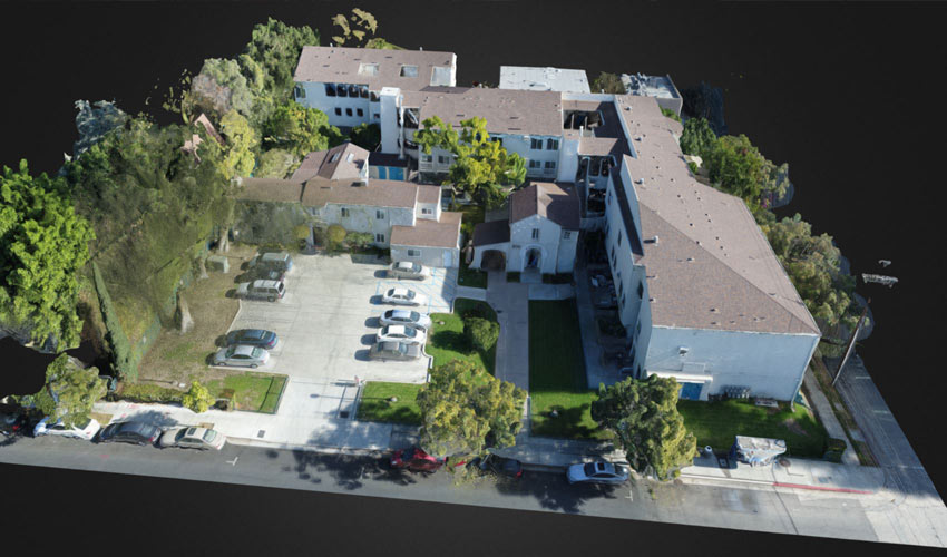
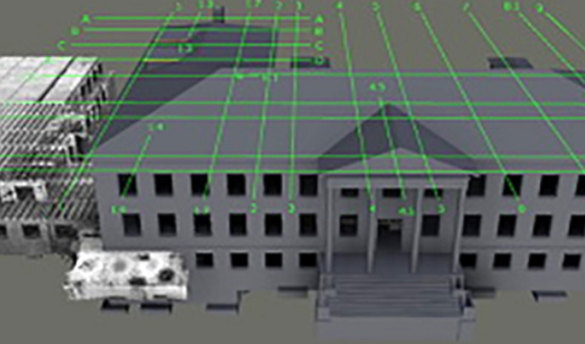
3D Modeling
3D modeling creates a vivid display of your development site and provides a collaborative experience with clients and field personnel. In a fraction of the time it would take for a ground-based survey crew to provide the same information, we can provide accurate measurements of your site and create detailed 3D imaging.
Learn more at Pacific States Aerial.
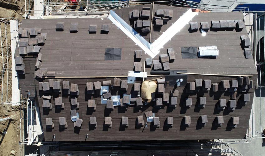
Aerial Inspections
Aerial imagery allows for detailed inspections of the building envelope (below-grade, walls and roofing) that cannot be captured by ground-based inspections. Drones allow for a detailed inspection to be performed without damaging the roof and placing the inspector in unsafe conditions.
Learn more at Pacific States Aerial.
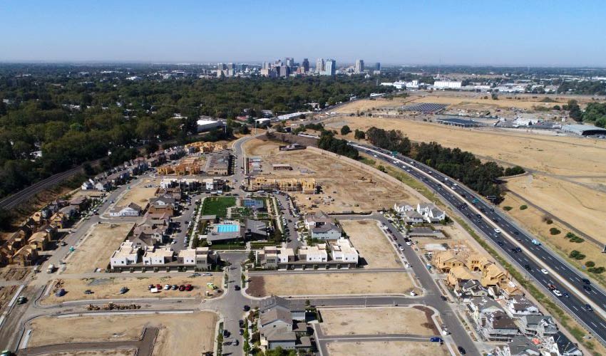
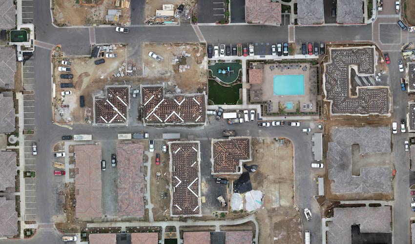
Aerial Mapping
Pacific States Aerial offers time-lapsed imaging of your jobsite on a scheduled basis, giving distant stakeholders a real view of the progress onsite via a 3D model. Further, the exported models can be used for taking measurements and are accurate within a ½ cm.
Learn more at Pacific States Aerial.
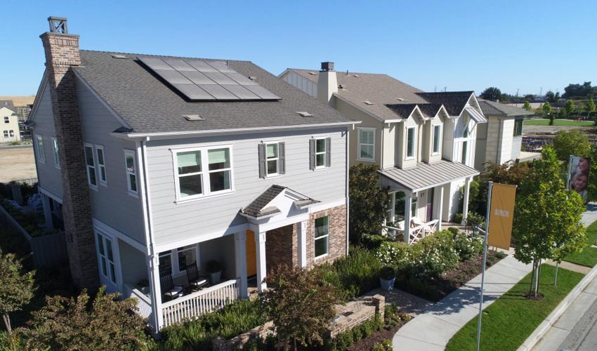
Marketing Photos & Videos
Using our state-of-the-art UAV equipment, software, and advanced experience in construction, Pacific States Aerial delivers professional quality aerial snapshots that provide critical information for many sectors, including precision planning and mapping for real estate development, environmental and surrounding area review and analysis for land planning, and more. Photo and video editing is also available.
Learn more at Pacific States Aerial.
Orthomosaics
Pacific States Aerial can create a highly detailed, up-to-date map that is in true scale. The meta-information within the orthomosaic map allows for point clouds, volumetrics, NDVI, 3D tours, and more.
Learn more at Pacific States Aerial.
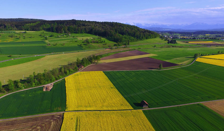
Plant Health
Drone technology can cut down labor requirements and reduce resource requirements (such as fresh water and pesticides), offering some relief to the modern-day farmer. Information provided by drone images can reveal the changing health and quality of plants, offering the information necessary to improve crop management.
Learn more at Pacific States Aerial.
Point Cloud Exports
In a fraction of the time it would take to conduct a ground‐based survey, a drone can capture imagery of a project site that can then be processed into highly accurate point clouds compatible with Building Information Modeling (BIM) software, and assisting builders in all stages of construction, including initial site survey and design, volume and elevation measurements and comparisons, and quality assurance.
Learn more at Pacific States Aerial.
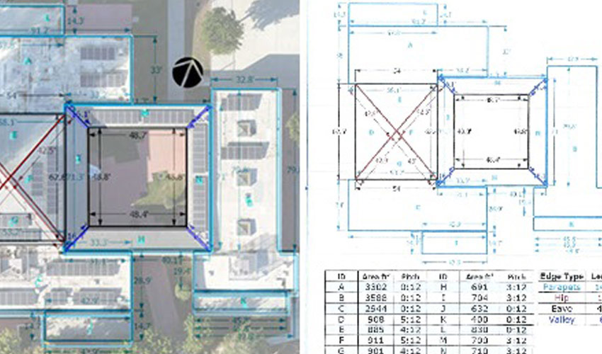
Site & Building Measurements
Drone mapping is a powerful new tool allowing inspectors to safely and easily capture high-resolution aerial views of a site in minutes. The technology captures accurate data quickly, including linear dimensions, area measurements, and slope calculations.
Learn more at Pacific States Aerial.
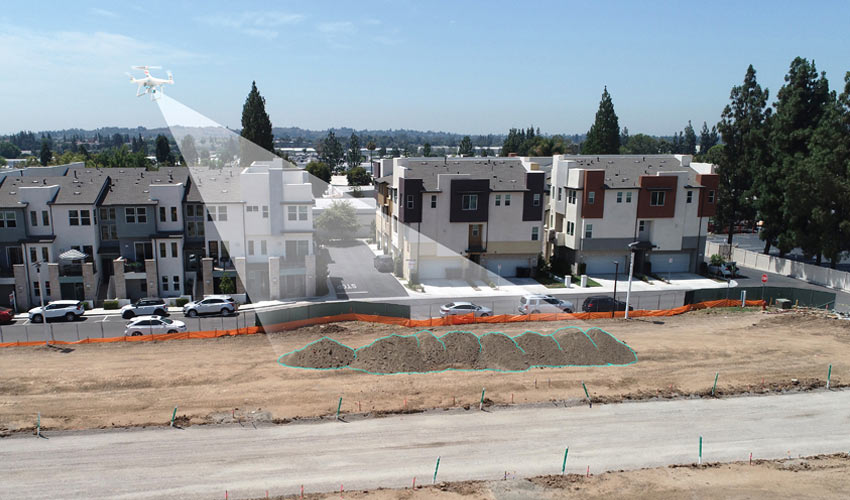
Volume Measurements
Accurate volume measurements can be provided from aerial imagery during grading operations for stockpile surveys, and even to estimate the amount of construction material delivered and available on‐site.
Learn more at Pacific States Aerial.